Chapter
1: GEOGRAPHY OF BOTSWANA
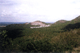
Botswana is a land locked country covering an area of 582,000 square kilometres with an approximate population of 1.7 million people. This chapter deals with both Physical and Human Geography. The physical environment of Botswana partly accounts for varied population distribution and low population density. Botswana’s climate is semi-arid. Rainfall is low, unreliable, unevenly distributed and highly variable from year to year. Drought is a recurrent phenomenon, most rivers are seasonal hence water is a scarce resource. The population is concentrated in the eastern part of the country where arable farming is possible on account of better and more favourable climatic and soil conditions. The physical environment of Botswana does not only influence the population distribution pattern and agricultural activities, but also influences mining and to a large extent manufacturing.

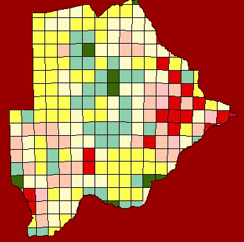
The Soils of Botswana
Chapter
2: GEOLOGY AND GEOMORPHOLOGY
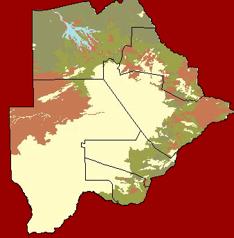
The Geological history and detailed rock formation structures are described in this chapter. The rocks of Botswana have formed over a period of over 3000 million years. The gold bearing rocks in the eastern part of the country evolved in Achaean times from two major episodes of sediment accumulation and volcanic activity, which were followed by earth movement and mountain building. Geologically, Botswana has remained stable for the past 500 million years. The Geomorphology of Botswana is divided into the Okavango Delta, the Sandveld and the Hardveld hypsographic regions. About two thirds of Botswana falls under the Sandveld or Kgalagadi desert. This region receives the least amount of rainfall compared to the rest of the country.

Structural Framework
The Geographical History
Chapter
3: WEATHER AND CLIMATE
The chapter deals with important climatic factors, which have influenced the weather and climate of Botswana. The climate is described as semi arid, with seasonal rainfall from November to March. Due to the country’s location, rainfall is low and the seasonal ranges of temperatures are high. The highest mean monthly temperatures range from between 32 Degrees Celsius and 35 Degrees Celsius and are generally recorded in the month of October and January. The lowest monthly temperatures are recorded between 1 Degrees Celsius and 5 Degrees Celsius over the southern and eastern and 5 Degrees Celsius to 7 Degrees Celsius in the northern parts of the country.
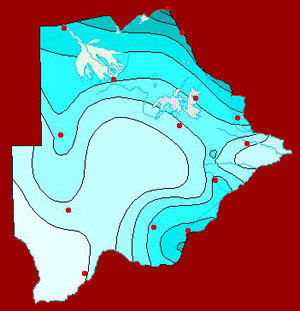
Mean annual rainfall
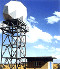
Surveillance weather radar
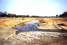
This chapter deals with the realisation of the hydrological cycle as it affects Botswana. All rivers in the country are seasonal except for the Okavango and Linyanti/Chobe rivers in the northern part of the country. There are six drainage basins or catchments, which assist in the design of water resource projects such as dams. The basins differ in catchment areas and flow system, with the Okavango Delta basin being approximately 12 000 square kilometres.
Surface Hydrology

The Okavango Delta
Chapter 5: HYDROGEOLOGY OF BOTSWANA
The chapter gives a broad overview of ground water in Botswana. For the past years Batswana have been digging wells in the ground to get water beneath the earth’s surface for drinking and other purposes. These have been in existence for a long time in Tswana culture. Groundwater in Botswana as in all other places around the world occurs in geologic formation known as aquifers, which may be defined as a formation that may either be a consolidated rock or unconsolidated pile of sediments, that contain sufficient saturated permeable material to yield significant quantities of water wells and springs.
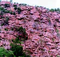
Fractured Rock outcropping in the north-western part of Botswana.
The chapter describes the elements of water resources, the administrative and legal arrangements. Management of water resources is crucial to the country’s economy as well as the well being of the people. Most of the rural Botswana depends on groundwater whilst the urban depends on surface water harvesting. The strategy of Botswana's future water requirements is a subject of the National Water Master Plan 1992.
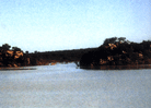
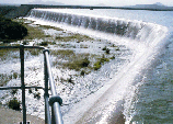
Letsibogo dam
Chapter
7: SOIL AND VEGETATION
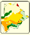
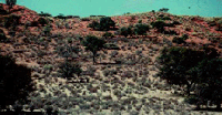
Soil and Vegetation variations create geographical differences in plant and animal life due to climate. The major soil groups are outlined in this chapter. About two thirds of the country is covered by sandy soils which are infertile. These are the red and grey desert soils on the Kalahari sands. Soil classification system is based on the legend of the soil map of the world. Various types of vegetation cover much of the country. These include grassland, natural woodland, forestland, savannah types, bush land, aquatic (wetlands) and man-made plantations. Vegetation resources play an important role in livestock farming and wildlife industries by their contribution to the national economy and well being of the citizens.
Chapter 8: NATIONAL CONSERVATION STRATEGY
The government of Botswana is committed to conserve the environment. This is evidenced by various policies outlined in this chapter. Despite the long tradition of environmental conservation, the country has, in the last twenty years, been experiencing growing pressure on the country’s natural resources due to population growth and industrial activity. This pressure necessitated the formation of the National Conservation Strategy, which promotes environmental conservation and sustainable development in the country. Botswana has taken steps to protect its environment through several means, which also include the development of a wastewater management service. Measures are outlined to improve the state of wastewater by incorporating public participation.
Degradation
Change ('84
to '94)

Waste Management
Chapter
9: AGRICULTURAL PRODUCTION
Agriculture involves the rearing of livestock and crop production. More than 80% of the population is engaged in agriculture and this plays a very important role in the economy of the country. The climate of the country is arid to semi-arid, thereby making cattle farming the main agricultural activity, which has resulted in Botswana being one of the major suppliers of beef to the European Union.
Sale of produce
Chapter
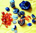
10: MINERALS AND MINING
Botswana is one of the
worlds leading diamond producers. Botswana has a long history of small-scale
mining. The major minerals mined in the country are diamond, copper and
nickel, coal, soda ash, salt and gold.
Diamond mining
Energy in Botswana is
derived from by different sources such as coal, wood, petroleum, electricity
and biogas. Wood fuel is the main source of household energy in rural
areas since it is cost free.
Statistics show that the residential sector is the largest consumer of
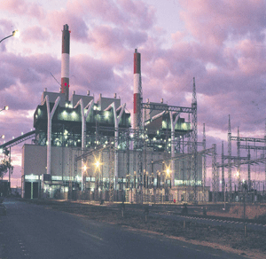
the total energy supply followed by industry and transport. Electricity
is generated and distributed by Botswana Power Corporation. It is generated
from coal-fired steam generators at Morupule Power Station in Palapye.
Botswana also imports part of its power from Namibia, South Africa,
Zambia and Zimbabwe for it is a member of Southern African Power Pool.
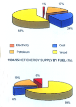
Energy Supply by Fuel
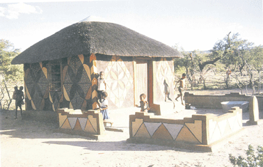
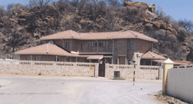
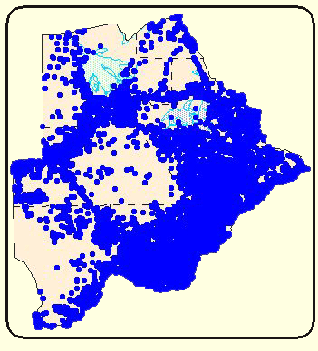
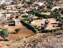
Settlements in Botswana are influenced by a number of factors including Population, Natural Resources, Infrastructure etc. The population of Botswana was largely rural at independence and about 96 percent of the population resided in the eastern part. In the mid 1970’s and1980’s the pattern of settlement changed, most people moved to urban centres.
Chapter
13: LAND INFORMATION AND MAPPING
Land Information is an
essential basic resource in the implementation of sustainable development
policies. The use of Land Information Systems (LIS) give support to land
management by giving information about the land, the resources upon it
and physical developments. All these land systems have a map as a final
product. In Botswana Land Surveying and Mapping have for a long time been
the major technologies employed in the gathering, compiling, processing,
storing, maintenance, display and dissemination of geo-spatial land information.
The employment of new and advanced technologies such as Remote Sensing
and Geographical Information System (GIS) has enabled the handling of
large volumes of spatial data.
Land Surveying is known to be one of the oldest professions in history
and may be broken down into four main types, Cadastral, Topographic, Geodetic
and Engineering. The primary role of Land Surveying in Botswana is concerned
with the security of ownership of land by the accurate definition of its
size and shape and registration of title to the land in the public register.
Botswana has a cadastre, which ensure that disputes over boundaries are
reduced.
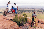
Geodetic Observation
Using GPS

SOS MAP System
Chapter 14:
LAND ADMINISTRATION, TENURE SYSTEM AND HOUSING
There are three main land tenures categories in Botswana and these are Tribal or Communal land which is 70%, State Land which is 25% and Freehold which is 5%.